Showing posts with label winter 4Ks. Show all posts

Wednesday, March 18, 2015

Cannon. March 16, 2015

Kinsman Ridge Trail, 4 miles roundtrip with 2100 feet elevation gain.

Cannon -- again!  We had planned to do something longer on Sunday, but Sunday's weather was just plain awful...rain plus snow plus more rain....I don't mind hiking in snow, and I don't mind hiking in rain during the summer...but snow + rain during the winter = too great a risk of hypothermia.  One of the important tricks to winter hiking is to avoid getting wet (and therefore dangerously cold).

So instead of a nice long hike on Sunday, we opted for a short, quick hike Monday morning.  The girls' scheduled schoolwork and extracurriculars kept us from staying out all day, but Cannon is close to our home and therefore a relatively quick excursion.


The trails boasted two to six inches of fresh powder, so we had a bit of work cut out for us.


Up we went.  The snow was light, so the effort wasn't too terribly strenuous.


We experienced the occasional one/two-foot drift...


...but we got to treeline sooner than we expected.  It was a bright, sunny day...but cold.  I didn't put on my balaclava before venturing out into exposure-ville, and I regretted it.  This wasn't quite frostbite weather, but my face was uncomfortable nonetheless.


We got up and over the last push, then we headed toward the summit tower.  I didn't take a photo up on top, since my hands were getting cold.


We lounged in the ski building and drank hot cocoa for a while before descending.

Franconia Ridge, one of our views while heading down Cannon
We got back to the car a bit after noon.


I'm grateful to live so close to many of these trailheads!

Hope you're all having a nice end-of-winter.

Wednesday, December 24, 2014

Mt. Monroe, December 22, 2014

Ammonoosuc Ravine Trail and Monroe Loop.  5.6 miles roundtrip with about 2872 feet of elevation gain.

Happy birthday to me!  And, happy almost-healed-foot to me!  The foot thing has been frustrating, because nothing serious was technically wrong with it.  Soft tissue damage or some such thing.  No broken bones and no ripped tendons...if my foot is going to hurt enough to keep me off the trails for over a month, then I want serious drama and nasty x-rays to make it worth my while.  Anyway, the wussy soft tissue thing seems to be 99% cleared up, so we were able to get out.

Monroe was our objective.  We arrived at the lower parking lot by the Cog around 7:00 am.  Only one vehicle was there before us -- it was owned by Rob, a fellow we'd later meet on the trail.

Walking to the trailhead from the winter parking lot .
Alex pauses to inspect her crampon.
The trail was packed solid from the weekend traffic.  My snowshoes got a free ride on my back all day long.  The girls and I made relatively short work of the relatively flat 1.3 miles to Gem Pool...though my body felt relatively heavy and relatively out of shape.


Gem Pool

On the way to Gem Pool, we passed Rob...we saw him again after we stopped to delayer and take a quick rest.  He was headed to Mt. Washington.  We set out ahead of him from Gem Pool and didn't see him the rest of the day -- it was nice to meet him and I hope he had an excellent hike.

Up, up, up....up we went.  The girls were glad they wore their Hillsound Pro crampons.  I wore microspikes...which worked well enough if I kick-stepped into the trail and angled my feet sideways.

Looking down after we've ascended a bit.

Views on the way up


Our only view of Washington all day long.  Clouds soon enveloped the mountain;
 the rest of our time on Monroe was in fog.

Time to layer up.

Sage heads into the White.

There's the hut -- no really, it's there.  See it?

Sign by the hut.  Good thing we know where we're going!

The main entrance to the Lakes of the Clouds hut, which is closed during the winter, is underneath all that snow.  The girls happily climbed to the roof and admired more view of Fog.


The way to Mt. Monroe from the hut...I am familiar with this trail, and with the mountain...otherwise, I would have been nervous.  We checked our compass frequently, just to be extra safe.


The half mile went quickly...the steep bits up the summit cone were snowy, not icy, so traction was never an issue.  We sat on the summit in the midst of Cloud.


Our Desserts on the 48 tradition continued with Mallomars on Monroe.


We didn't linger for long.  The temps weren't bad and the wind chills weren't unbearable...but all this White made me nervous, and I wouldn't feel 100% fine until we were back at the hut.

In between the real summit and the false one, I took a photo of the girls and their snow-hair.


Here's me and my own snow-hair...and snow hat...


Just before descending the summit cone, the sky cleared just a smidge and we could see the top of Jefferson in the distance.  We seemed to be right at the edge of what the folks on Mt. Washington would see as an undercast.  We were just below the top of cloud layer, so we saw mostly fog/cloud...with just a hint of view every now and then,


We stood and watched as the flank of Mt. Washington appeared..then disappeared...


The show was quickly over.  Cloud returned, so we descended.


The icy trail sign at the base of Monroe's summit cone...


Our view from the sign toward the hut.  Like I said, I was glad we knew the trail and the terrain.  We also knew which direction we should be heading...and the tracks from other hikers didn't hurt.


We met a fellow named Justin as we returned to the hut.  He was on his way toward Monroe -- he was a nice guy and it was a pleasure speaking with him.

Once at the hut, we prepared to gleefully butt-slide down much of Ammonoosuc.  We secured everything inside our packs and took a few more gulps of water.  Just before we began the descent, we met two young men with accents (German?) who were heading toward Washington.  We exchanged pleasantries, then we went on our way.

We walked down most of the above-treeline bits of Ammo...didn't want anyone to accidentally slide off into the ravine.  Just before entering the trees, we met Emerel, a fellow who posts on New England Trail Conditions.  We spoke with him for five minutes or so.  Nice fellow -- I'd love to share a hike with him sometime.  He too was headed toward Washington (and then Monroe).  We eventually parted ways -- I hope he had a fine time of it up there.

The descent below treeline was quick...we walked as much as we could and butt-slid down the extremely steep parts...which, if you've ever hiked Ammo, is most of the upper mile of the trail.  For this reason alone, I recommend all who hike Ammo bring crampons.  Lots of people butt-slide down this trail...it's part of the fun of winter hiking...so be prepared and bring the serious traction for your ascent.

The girls chased each other down most of the lower mile (after Gem Pool).  They paused at the trailhead long enough for me to get this photo...


...then they chased and playfully shoved each other all the way back to the car.  I think their goal was to fall into the snow as often as possible.

We'll likely get out again between Christmas and New Year's.  Have a wonderful holiday, everyone!

Monday, February 10, 2014

Hermits on the Hancocks (Desserts on the 48). Feb 9, 2014

Woo-hoo!  My leg feels completely back to normal.  Hooray for stretches and recovery exercises!

The girls and I got back into the woods yesterday and ascended a couple of mountains.  It felt wonderful!  I think we can now resume our usual once-a-week hiking routine.

We are currently chasing multiple lists, but in a casual fashion.  During the next six months -- hopefully, before we leave for the John Muir Trail in August -- we should finish, or almost finish, the following lists: 52 With a View (Sage), Trailwrights 72 (Alex), Desserts on the 48 (both girls), and the Terrifying 25 (both girls).  FYI, we made up the last two lists (we enjoy rock scrambling, and we all wanted to do another round of the NH48...this time, with different desserts).  When we come back from California in late August/early September, we'll probably start visiting the New Hampshire peaks we haven't yet seen.  We live in a gorgeous area of the country, and the girls love to get out there, so why not keep exploring.

The hike up the Hancocks was the perfect get-back-into-it venture.  The first part of this trek is 1.8 miles of flatness along the Hancock Notch Trail.  All that flatness gives a recovering body ample time to get warmed up before hitting the steeps.

The entrance to the trail, in the parking lot off Route 112.

The trail was nicely packed from the previous day's foot traffic, so we didn't need to wear our snowshoes.

1.8 miles of flat!

We took a short water break by the first intersection.  Then it was on to 0.7 miles of Cedar Brook Trail.


Crossing a snowed-over stream.

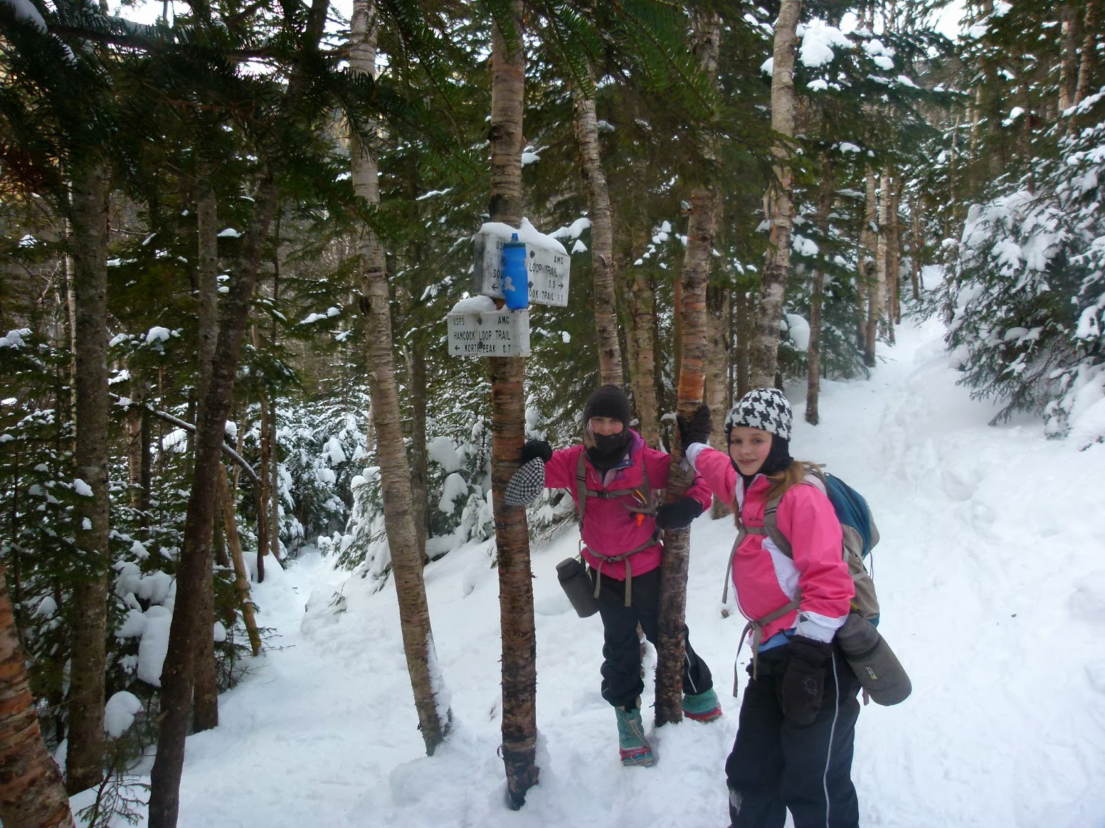
We reached the Hancock Loop Trail, took a few more gulps of water, and walked the 1.1 miles to the beginning of the actual loop.


This part of the trail's grade is easy-to-moderate.  It only gets steep on the actual loop over the peaks.


Sage with frosty hair and eyelashes.

Loop time!  We chose the common North-first approach so we could experience the dangerous joy of butt-sliding down South Hancock.


The trail up North Hancock goes down for a tenth of a mile, then it ascends steeply for six tenths of a mile.  Up to this point, the girls and I had flown through the woods.  When we reached this stretch, however, I had to slow down.  Alex and Sage kept their same pace, which meant they kept going ahead of me, way out of eyesight.  Both of them now hike like fit young athletes, whereas I hike like an aging mom.  There may soon come a time when I ask folks I trust in the hiking community, young adults known for their quick pace and strong (and safe) hiking skills, to allow my girls to go with them from time to time so they can keep hiking to their ability (and not be handicapped by the presence of their mom).


On top of North Hancock...


We're counting this as part of our quest for Desserts on the 48.  Store-bought hermits served as our summit treat.

We're not paid to endorse these hermits.  We simply find them yummy.

The temperature up top was a balmy fifteen degrees (F), but the sun was out and we felt fairly warm.  We therefore lounged for a few minutes and soaked in the view before continuing the 1.4 miles to South Hancock.

Moving along the ridge toward South Hancock.


On South Hancock.


We lounged for a while on this peak, too.  Eventually, we got up and began the crazy-steep 0.5 mile descent back to the loop intersection.


Sage looking at Arrow Slide and North Hancock.
After this photo was taken, we sat and descended via buttsliding.

I don't have photos of our buttsliding descent.  I was concentrating on protecting the girls and not impaling myself on any branches while we zoomed down at approximately 100 miles an hour.  The girls laughed hysterically all the way down the mountain, and we all ended up with frozen rear ends and huge smiles on our faces.

This was my fourth time, Alex's third time, and Sage's second time on the Hancocks.

'Twas an excellent day in the woods.