Monday, August 24, 2015
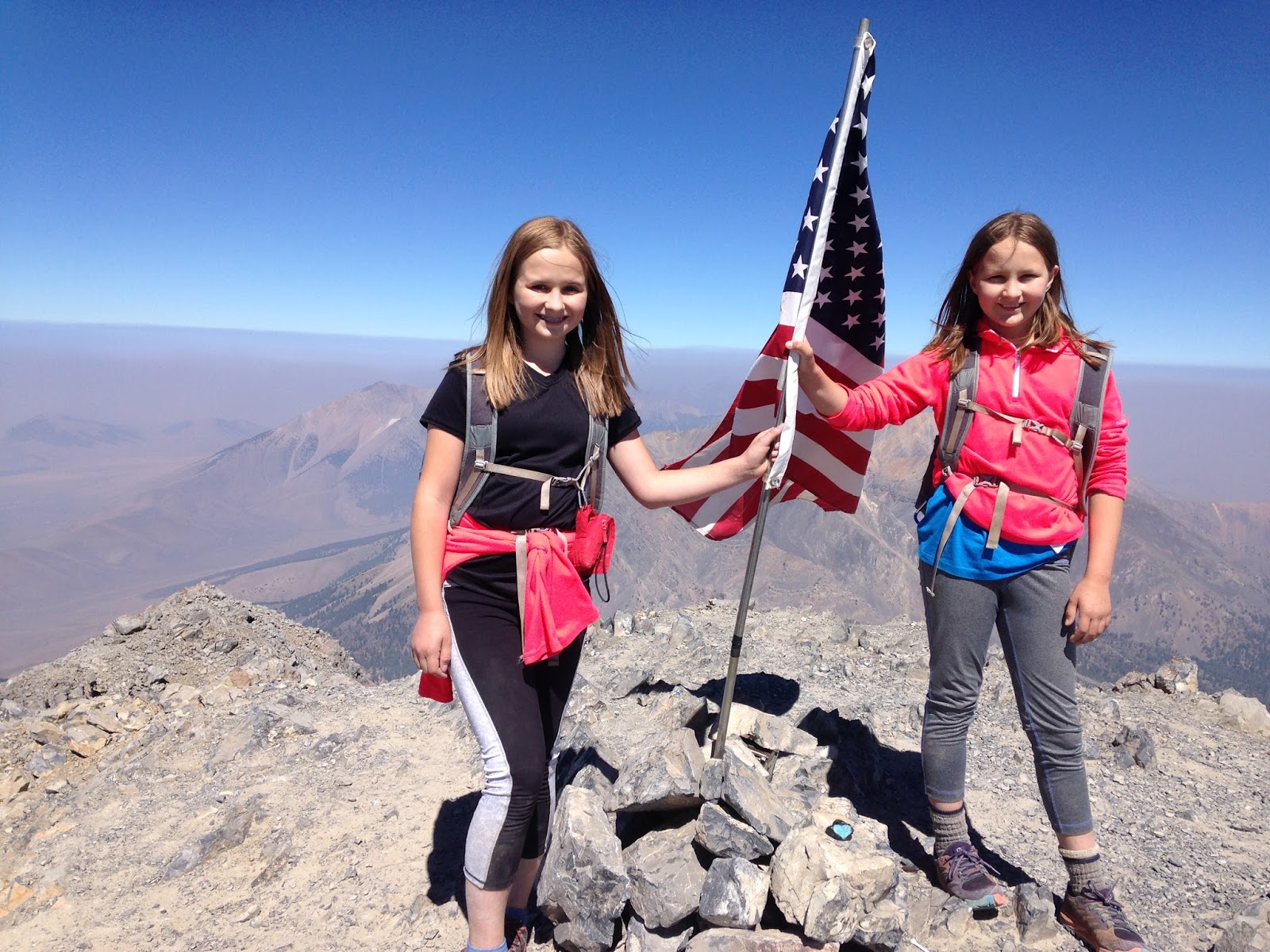
Borah! Aug. 23, 2015
We highpointed Idaho yesterday! Got Borah on a beautiful day. Will write a full trip report later -- for now, here's a picture of the girls on the summit.

Saturday, August 15, 2015
Our next (and last?) highpointing attempt...
..will be Idaho's Borah Peak. We are about to take a long road trip for a month or so. Somewhere in there, we will attempt Borah Peak. Of course, if my ankle isn't feeling up to it, then we won't give it a go...but I am feeling more and more certain that it will be just fine after another 7+ days.
We may or may not summit Borah -- I have done a lot of research on Chicken Out Ridge, and I have no idea if we will be comfortable with the scrambles...we will see when we get there.
I also have no idea if we will attempt the rest of the highpoints after we (maybe) summit Borah. The rest -- Gannet, Granite, Hood, Rainier, and Denali -- all require mountaineering skills. Up to this point, we consider ourselves extremely experienced hikers and rock scramblers. I am not a climber, and, right now, I have zero experience roping myself to my kids. Therefore, it would be foolish and arrogant of me to state that we will definitely continue after Borah. If Alex and Sage decide they do want to keep going, then we will spend a lot of time learning new skills during this next year. If they decide they want to stick to hiking, then there is no shortage of thru-hikes we can enjoy every summer. There are so many trails I want to tackle!
Since the girls are young, and since they have broken many "youngest" records here in the White Mountains, I have been repeatedly asked if we are trying to break the "youngest female" highpointing record. I know that if the girls wanted to, they could...one more summer, maybe two, would do it, at least for all but Denali. However, that is NOT a reason to hike mountains. The records they have broken here have all been accidental, a matter of happenstance. We hike all the time, so therefore various records have been broken simply because my girls happen to be young. It has never been our intent to hike anything simply to establish or break a record. I do not feel that is a healthy motivation, at least, not for my children. Mountain hiking and climbing can be very dangerous, deadly if one isn't careful, and to hike something simply to be the "youngest whatever" adds an additional layer of "summit fever" risk. I want my kids to hike because they love to hike, and to scramble up peaks because they love to...not to chase a record that will inevitably be broken by someone else in a few short years (or months) anyway.
I will report back here in mid-September. We'll either summit Borah or we won't...either way, we are going to have a great time out West.
Blueberry Mountain (52WAV). Aug. 13, 2015
Blueberry Mountain Trail (from Glencliff)
3.4 miles roundtrip, with just over 1000 feet of elevation gain.
It had been a week since I sprained my ankle coming down Glen Boulder Trail. I had kept off it as best I could...however, as a single mom with two kids, three cats, and a dog, I can't exactly keep my feet up for days on end. Therefore, I had been walking on my ankle in spite of being told to stay off it...in spite of this, by the time Thursday rolled around, it was feeling fairly stable and pain-free when wrapped. I therefore decided to get back out there and try a small, easy (by White Mountain standards) trail. Alex hadn't done Blueberry Mountain before, so we decided to take a slow stroll up this easy 52 With a View peak.
The last time I had been up this way was with Sage when she was 4 years old. I remembered the trail as being gentle but ledgy, something my ankle could handle...and if it couldn't, then the trail should be easy enough for me to crawl down.
We started at the late (for us) time of 9:40am. I walked at a pace that was comfortable for my ankle. Turned out I averaged 1.7 mph, which is much slower than we would usually hike this kind of terrain, but not at all bad considering I was healing from a sprained ankle.


The trail to the summit splits off the main trail, and it can be confusing to find it if you aren't looking carefully. You will reach a section that flattens out, and there will be a rock to your right with a green splotch of paint on it. That is the entrance to the short trail that leads to the summit. If you miss this bit and continue onward, you will soon find yourself descending the other side of the mountain.

I propped up my foot and we ate snacks. My ankle felt tired and weak, but not painful.
The descent was straightforward, but with views! All of this had previously been at our backs.


Our total time for the hike was three hours, which included the time spent lounging at the top. My ankle felt decent enough, and I was able to drive home with no problems. At home, when I unwrapped the foot, I saw that the injured parts had swollen a tiny bit. Not bad for one week after my injury. I think my ankle is definitely on the mend, and that I should be 100% in another week or two.
That was our last hike before we head out west to attempt Borah Peak, I will write another post on that subject soon.
3.4 miles roundtrip, with just over 1000 feet of elevation gain.
It had been a week since I sprained my ankle coming down Glen Boulder Trail. I had kept off it as best I could...however, as a single mom with two kids, three cats, and a dog, I can't exactly keep my feet up for days on end. Therefore, I had been walking on my ankle in spite of being told to stay off it...in spite of this, by the time Thursday rolled around, it was feeling fairly stable and pain-free when wrapped. I therefore decided to get back out there and try a small, easy (by White Mountain standards) trail. Alex hadn't done Blueberry Mountain before, so we decided to take a slow stroll up this easy 52 With a View peak.
The last time I had been up this way was with Sage when she was 4 years old. I remembered the trail as being gentle but ledgy, something my ankle could handle...and if it couldn't, then the trail should be easy enough for me to crawl down.
We started at the late (for us) time of 9:40am. I walked at a pace that was comfortable for my ankle. Turned out I averaged 1.7 mph, which is much slower than we would usually hike this kind of terrain, but not at all bad considering I was healing from a sprained ankle.


 |
| Blueberries on Blueberry Mountain! |


The trail to the summit splits off the main trail, and it can be confusing to find it if you aren't looking carefully. You will reach a section that flattens out, and there will be a rock to your right with a green splotch of paint on it. That is the entrance to the short trail that leads to the summit. If you miss this bit and continue onward, you will soon find yourself descending the other side of the mountain.
 |
| Heading up... |
 |
| Summit! |

The descent was straightforward, but with views! All of this had previously been at our backs.


Our total time for the hike was three hours, which included the time spent lounging at the top. My ankle felt decent enough, and I was able to drive home with no problems. At home, when I unwrapped the foot, I saw that the injured parts had swollen a tiny bit. Not bad for one week after my injury. I think my ankle is definitely on the mend, and that I should be 100% in another week or two.
That was our last hike before we head out west to attempt Borah Peak, I will write another post on that subject soon.
Saturday, August 8, 2015
Isolation via Huntington Ravine Trail, Davis Path, Glen Boulder, etc. August 6, 2015
Tuckerman Ravine Trail, Huntington Ravine Trail, Alpine Garden Trail, Lawn Cutoff, Davis Path, Glen Boulder Trail, Direttissima.
15.5 miles with 5400 feet of elevation gain.
The good news -- the girls finally got to climb Huntington Ravine Trail. The bad news -- I sprained my ankle on the way down Glen Boulder Trail, about 2.3 miles from the car. The not-so-bad news -- I should be fine within weeks...hopefully in time to climb Idaho's Borah Peak. We'll see.
It was a great day with crazy weather. We started out not knowing if we'd need to turn back before reaching the headwall. The NOAA forecast predicted no rain...yet the skies looked interesting.
We began the day on Tuckerman Ravine Trail at 6:30am. A kind lady took this photo.

We walked as quickly as we could since we were eager to experience Huntington Ravine Trail.

1.2 miles later, here we are...2.1 more miles to go until we reach the top of the headwall.

The lower parts of HRT take you through trees and over water. There are more than a few scenic spots.

We reached the First Aid cache that is dedicated to Albert Dow. Alex and Sage are well aware of the significance of this area, and we spent some time in reflective conversation. They know, they understand. They have great respect for Mr. Dow, and for all members of Search and Rescue.

By the way, Alex noticed there is graffiti on that building, and one of the names scratched there is "Alex." The person who did that is NOT our Alex -- this was the first time the girls have visited this area -- and neither of my girls would ever deface a building, let alone that particular building.
Once in the ravine, you reach a boulder field, through which you must climb/wind your way up until you arrive at the fan.


We reached the fan...and part of it was wet. This is the trickiest part of the hike, at least for me (I did this hike with a friend last month, so I knew what to expect). I climbed halfway up to test for grip and decided the girls could handle it. This was the only wet portion of the trail up the headwall. However -- if you are new to hiking, and/or if you are uncomfortable with tricky scrambles and/or heights, then I strongly advise that you do this trail only if it is a bright and sunny day, and only when the rocks are bone dry.
The girls made their way up. I have photos of only two sections -- the rest of the time, I needed to use both my hands and couldn't get to my iPhone. If you do a Google search on Huntington Ravine Trail, you will find many photos of the various scrambles and chimneys up the headwall. We happily managed all of them (with care). Below are my only photos...wish I could have gotten more.


We topped out on Alpine Garden Trail around 9:30am. It was WINDY and cold. We had been protected from the wind and chill while climbing HRT.

After layering up, we walked the Alpine Garden Trail and made our way to Davis Path via the Lawn Cutoff. Normally, this hike has outstanding views. Today, however, we had Cloud. Also, twenty minutes after arriving at the top of the headwall, it started raining. Our hike basically looked like this until we reached treeline on the Davis Path...

We felt the wind full blast as we passed the intersection with Glen Boulder Trail. The girls each got blown off their feet a couple of times (they enjoyed the experience).


The fog started to clear just as we reached treeline (of course!).
Once below treeline, we marveled at how much easier it is to walk when you don't have gusts of wind slamming into you every other second.
I captured some goofy moments...


Heading down Davis Path...

Sage needed North Isolation for her Trailwrights 72 list. The summit isn't marked, so we stood on all the high bits in the appropriate area and took a bunch of photos. This is one of those photos.


Iced Cookies on Isolation for our Desserts on the 48 quest!


We had hiked 8.9 miles with about 4000 feet of elevation gain. Once fed and rested, we headed back up the Davis Path, hiking another 2.8 miles and regaining 1400 feet of elevation to the intersection with Glen Boulder Trail. The sun was out and we now had views above treeline. The wind was still fierce, though.

We reached the intersection with Glen Boulder Trail and headed down.

We paused and ate chocolate on Slide Peak.

Continuing down, we reached Glen Boulder.

A few minutes after taking the above photo, I turned my right ankle while descending a slanted boulder. There was a SNAP followed by pain. The girls rushed to my side, and I panicked for a second, thinking they weren't going to be careful with their own footing and that we'd soon have three injured hikers instead of one. I told them thank you, but their one and only job was to look after themselves, as I was now not in a good position to help them if they became injured. I drank a sip of water, then began crab-walking (with one leg) down the rest of the boulder section. Alex found an abandoned walking stick soon after we reached treeline, and I used that as a crutch.
Our remaining 2.3 miles took forever, but I was able to walk as long as I held my ankle firmly in one position. I did not want to stop to wrap it, I just wanted to go go go. I knew adrenaline was keeping the pain away, and I wanted to get to the car...I did NOT want to call Search and Rescue. SAR is full of wonderful people, but I am a strong believer in self-rescue if at all possible. The girls were warm, we had food and water with us, and, if it came to it, they could get back down to the parking lot on their own. I therefore hobbled out with the help of the stick, and with the constant encouragement of both my daughters. Alex and Sage were great, they really were.
We eventually made it back to the car. I took off my shoes and socks, and....

Hmmm..not good. Driving wasn't an issue as long as I didn't flex the ankle (instead, I lifted the entire foot with my leg). When I got home, all I wanted to do was drink a beer and go to sleep...so that's what I did. The next morning, I got X-Rays. It's a torn ligament, with a bit of bone pulled off for good measure. The cure -- rest, wrap, and elevate. I should be good to go again within a few weeks. Maybe sooner, maybe later, we'll see.
All in all, it was a great day with much fun. I'm glad we did this -- we were planning on a Presidential Traverse next week, and, since the girls handled this hike with relative ease, I am pretty sure we can handle that kind of massive dayhike. However, that now that needs to wait until my ankle heals...we hope to do the traverse in late September or October.
15.5 miles with 5400 feet of elevation gain.
The good news -- the girls finally got to climb Huntington Ravine Trail. The bad news -- I sprained my ankle on the way down Glen Boulder Trail, about 2.3 miles from the car. The not-so-bad news -- I should be fine within weeks...hopefully in time to climb Idaho's Borah Peak. We'll see.
It was a great day with crazy weather. We started out not knowing if we'd need to turn back before reaching the headwall. The NOAA forecast predicted no rain...yet the skies looked interesting.
We began the day on Tuckerman Ravine Trail at 6:30am. A kind lady took this photo.

We walked as quickly as we could since we were eager to experience Huntington Ravine Trail.

1.2 miles later, here we are...2.1 more miles to go until we reach the top of the headwall.

The lower parts of HRT take you through trees and over water. There are more than a few scenic spots.

We reached the First Aid cache that is dedicated to Albert Dow. Alex and Sage are well aware of the significance of this area, and we spent some time in reflective conversation. They know, they understand. They have great respect for Mr. Dow, and for all members of Search and Rescue.

By the way, Alex noticed there is graffiti on that building, and one of the names scratched there is "Alex." The person who did that is NOT our Alex -- this was the first time the girls have visited this area -- and neither of my girls would ever deface a building, let alone that particular building.
Once in the ravine, you reach a boulder field, through which you must climb/wind your way up until you arrive at the fan.

 |
| Interesting sky... |


We reached the fan...and part of it was wet. This is the trickiest part of the hike, at least for me (I did this hike with a friend last month, so I knew what to expect). I climbed halfway up to test for grip and decided the girls could handle it. This was the only wet portion of the trail up the headwall. However -- if you are new to hiking, and/or if you are uncomfortable with tricky scrambles and/or heights, then I strongly advise that you do this trail only if it is a bright and sunny day, and only when the rocks are bone dry.
The girls made their way up. I have photos of only two sections -- the rest of the time, I needed to use both my hands and couldn't get to my iPhone. If you do a Google search on Huntington Ravine Trail, you will find many photos of the various scrambles and chimneys up the headwall. We happily managed all of them (with care). Below are my only photos...wish I could have gotten more.


We topped out on Alpine Garden Trail around 9:30am. It was WINDY and cold. We had been protected from the wind and chill while climbing HRT.

After layering up, we walked the Alpine Garden Trail and made our way to Davis Path via the Lawn Cutoff. Normally, this hike has outstanding views. Today, however, we had Cloud. Also, twenty minutes after arriving at the top of the headwall, it started raining. Our hike basically looked like this until we reached treeline on the Davis Path...

We felt the wind full blast as we passed the intersection with Glen Boulder Trail. The girls each got blown off their feet a couple of times (they enjoyed the experience).


The fog started to clear just as we reached treeline (of course!).
 |
| Isolation is in the fog. |
Once below treeline, we marveled at how much easier it is to walk when you don't have gusts of wind slamming into you every other second.
I captured some goofy moments...


Heading down Davis Path...

Sage needed North Isolation for her Trailwrights 72 list. The summit isn't marked, so we stood on all the high bits in the appropriate area and took a bunch of photos. This is one of those photos.

Isolation!!


Iced Cookies on Isolation for our Desserts on the 48 quest!


We had hiked 8.9 miles with about 4000 feet of elevation gain. Once fed and rested, we headed back up the Davis Path, hiking another 2.8 miles and regaining 1400 feet of elevation to the intersection with Glen Boulder Trail. The sun was out and we now had views above treeline. The wind was still fierce, though.

 |
| View toward the southern Presidentials |

We paused and ate chocolate on Slide Peak.

Continuing down, we reached Glen Boulder.

A few minutes after taking the above photo, I turned my right ankle while descending a slanted boulder. There was a SNAP followed by pain. The girls rushed to my side, and I panicked for a second, thinking they weren't going to be careful with their own footing and that we'd soon have three injured hikers instead of one. I told them thank you, but their one and only job was to look after themselves, as I was now not in a good position to help them if they became injured. I drank a sip of water, then began crab-walking (with one leg) down the rest of the boulder section. Alex found an abandoned walking stick soon after we reached treeline, and I used that as a crutch.
Our remaining 2.3 miles took forever, but I was able to walk as long as I held my ankle firmly in one position. I did not want to stop to wrap it, I just wanted to go go go. I knew adrenaline was keeping the pain away, and I wanted to get to the car...I did NOT want to call Search and Rescue. SAR is full of wonderful people, but I am a strong believer in self-rescue if at all possible. The girls were warm, we had food and water with us, and, if it came to it, they could get back down to the parking lot on their own. I therefore hobbled out with the help of the stick, and with the constant encouragement of both my daughters. Alex and Sage were great, they really were.
We eventually made it back to the car. I took off my shoes and socks, and....

 |
| Temporarily out of order |
All in all, it was a great day with much fun. I'm glad we did this -- we were planning on a Presidential Traverse next week, and, since the girls handled this hike with relative ease, I am pretty sure we can handle that kind of massive dayhike. However, that now that needs to wait until my ankle heals...we hope to do the traverse in late September or October.
Depending on my ankle, we may do a small 4K late next week. We'll take it slowly and see how it goes.
Sunday, August 2, 2015
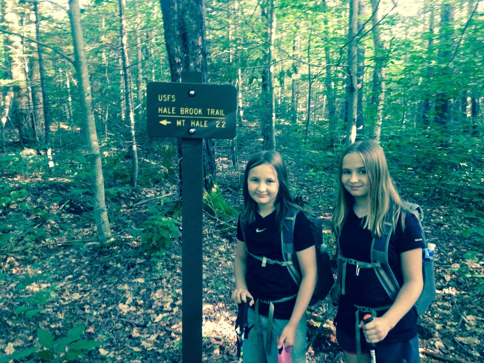
Hale. July 30, 2015
Hale Brook Trail. 4.4 miles roundtrip with 2300 feet of elevation gain.
Thunderstorms were in the forecast for the afternoon, so we did a quick hike of Hale in the morning. We didn't get to the trailhead until 8:15am, which is late for us, and it was humid when we started out. We tend to melt with the heat and humidity, so, though we made good time and were back to the car by 11:10, the trail felt much longer than it usually does.
Starting out (forgive the color skew of the first five photos...my iPhone wasn't behaving)...


The trail never gets steep, it stays moderate throughout, but we were ready to dunk our heads in this crossing (at roughly the halfway point) after hiking in the heat.


Up we went, up more moderately-steep stretches and switchbacks...we felt hot and uncomfortable, so we actually drank most of the water we brought (we usually carry way more than we need).

Summit!


We sat and ate for about twenty minutes, then we headed down. From the top of the cairn, I could see clouds starting to build...the clouds were far away, but I knew the forecast and predicted the clouds would get darker and closer over the next couple of hours. I was glad we were heading down...and I was a bit surprised to see two groups (a couple and a trio) heading up. I didn't mention the storms to them, since I figured these folks knew what they were doing. Some folks don't mind hiking in storms as long as they aren't exposed (there's no exposure on Hale except for the very top).
We reached the car at 11:10. A woman and her son were about to head up -- they looked like they were new to hiking, and her question confirmed this...she asked me how long it had taken for us to hike the trail. I responded by telling her that the girls were experienced and that we had done this trail many times, so our pace might be relatively fast. When I told her it had taken us three hours, including breaks and time lounging on the summit, she seemed to think that was very slow...which, again, confirmed my suspicion that they were beginning hikers (our pace would be slow for flat ground, but it's decent for steep trails). I did not mention the probable incoming storms, because I figured they had seen the forecast and would turn around if they weren't moving as fast as they'd hoped. However, Alex regretted not mentioning the weather probability, and, later, she kept saying we should have warned them. I have mixed feelings about it -- they were new, yes, but I also feel it can come across as obnoxious to give unsolicited advice...and it's very possible they knew the forecast and figured they'd see how far they could get before realizing they'd have to turn around. I haven't heard anything about them through the news or through Search-and-Rescue, so I am going to assume they made it down before those storms arrived (and they did indeed arrive, around 2:30)...or that they got rained on, but made it down just fine.
The girls and I will hike next week...hopefully we'll get Huntington Ravine Trail...the weather needs to cooperate on the days we have available to hike.
Thunderstorms were in the forecast for the afternoon, so we did a quick hike of Hale in the morning. We didn't get to the trailhead until 8:15am, which is late for us, and it was humid when we started out. We tend to melt with the heat and humidity, so, though we made good time and were back to the car by 11:10, the trail felt much longer than it usually does.
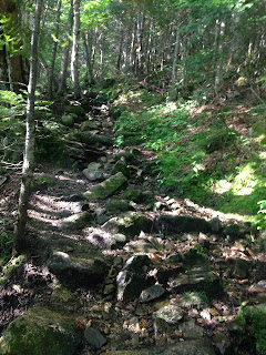
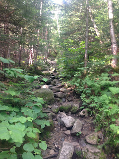
Starting out (forgive the color skew of the first five photos...my iPhone wasn't behaving)...

The trail never gets steep, it stays moderate throughout, but we were ready to dunk our heads in this crossing (at roughly the halfway point) after hiking in the heat.


Up we went, up more moderately-steep stretches and switchbacks...we felt hot and uncomfortable, so we actually drank most of the water we brought (we usually carry way more than we need).


Summit!


We sat and ate for about twenty minutes, then we headed down. From the top of the cairn, I could see clouds starting to build...the clouds were far away, but I knew the forecast and predicted the clouds would get darker and closer over the next couple of hours. I was glad we were heading down...and I was a bit surprised to see two groups (a couple and a trio) heading up. I didn't mention the storms to them, since I figured these folks knew what they were doing. Some folks don't mind hiking in storms as long as they aren't exposed (there's no exposure on Hale except for the very top).
We reached the car at 11:10. A woman and her son were about to head up -- they looked like they were new to hiking, and her question confirmed this...she asked me how long it had taken for us to hike the trail. I responded by telling her that the girls were experienced and that we had done this trail many times, so our pace might be relatively fast. When I told her it had taken us three hours, including breaks and time lounging on the summit, she seemed to think that was very slow...which, again, confirmed my suspicion that they were beginning hikers (our pace would be slow for flat ground, but it's decent for steep trails). I did not mention the probable incoming storms, because I figured they had seen the forecast and would turn around if they weren't moving as fast as they'd hoped. However, Alex regretted not mentioning the weather probability, and, later, she kept saying we should have warned them. I have mixed feelings about it -- they were new, yes, but I also feel it can come across as obnoxious to give unsolicited advice...and it's very possible they knew the forecast and figured they'd see how far they could get before realizing they'd have to turn around. I haven't heard anything about them through the news or through Search-and-Rescue, so I am going to assume they made it down before those storms arrived (and they did indeed arrive, around 2:30)...or that they got rained on, but made it down just fine.
The girls and I will hike next week...hopefully we'll get Huntington Ravine Trail...the weather needs to cooperate on the days we have available to hike.
Subscribe to:
Posts (Atom)