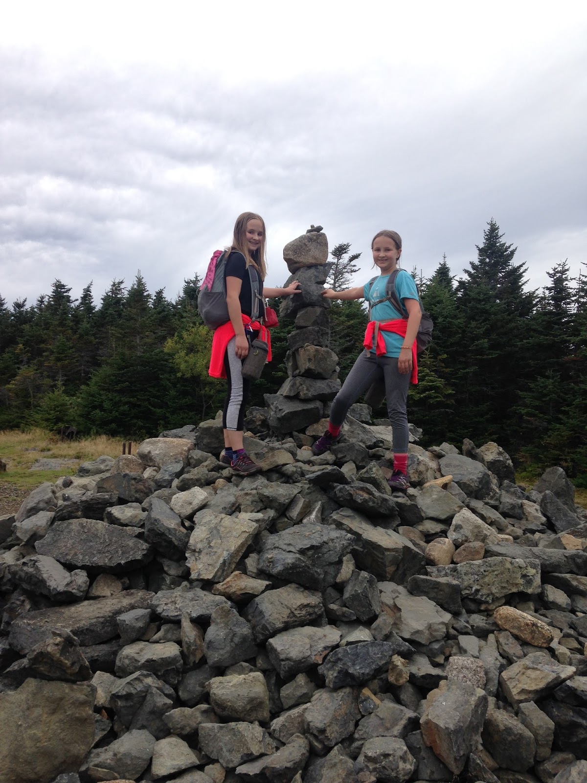
Our 45th highpoint!
About 7 miles roundtrip with approximately 5100 feet of elevation gain.
*****************
Wasn't sure this one was going to happen this year -- I managed to turn my ankle and earn an avulsion fracture two weeks before we began driving west from New Hampshire. I knew I would not cancel the road trip as long as I could drive...I figured if my ankle wasn't well enough for Borah by the time we got there, then we would still have fun doing all the other things we'd planned -- Yellowstone, Craters of the Moon, the Badlands, etc. etc.
One week after the fracture, I did a small hike of 3.4 miles up a gentle mountain. All was well, though the ankle swelled up again.
Two weeks after the fracture, we were on the road. By this time, the ankle was still fairly big, but no longer painful, and I could walk without a limp.
I am not a doctor, but I have a theory...the constant press-release on the the gas pedal for ten+ hours a day, five days a week, might be excellent physical therapy for an injury like mine. By the time we arrived in Idaho, my ankle felt mostly normal. It was still slightly swollen, but I could hop on it without pain, and it felt stable. I therefore decided to wrap my ankle for extra support and give Borah a go. If my ankle bothered me during those first two (steep) miles, then we'd turn around before reaching Chicken-Out-Ridge.
Besides my ankle, there was another concern...on each and every hike of a mountain over 10,000 feet, the girls and I have always taken at least four days to acclimate. By the time we arrived in Idaho, we had acclimated to 5 or 6000 feet simply because we had driven across the country and the land naturally rises. We had also slept two nights at 9000 feet with no ill effects. However, that was the extent of our acclimating...again, we figured we would turn around before Chicken-Out-Ridge if anyone began to feel woozy.
Then, of course, there was the final concern of Chicken-Out-Ridge itself. We have friends who have climbed it, and we've watched videos online, and we've seen pictures. Still, images never really give you a true feel for a mountain. Alex and Sage were excited to see COR, since they had heard/seen so much about it, and we all agreed we'd simply turn back if anyone felt like she couldn't or didn't want to do it.
We stayed in Mackay, which is the closest town to Borah. We used a hotel -- the Bear Bottom Inn, to be precise (decent rates, nice rooms, friendly owner). If one wants to camp, however, there are ample opportunities. You can camp at the trailhead -- but there is no water, you must bring your own. There are also campgrounds in Mackay and there's a campground by a lake between Mackay and the turn-off for Borah.
We had boots on trail by 5:40am. Note: the access road to the trailhead is easy to drive...a low clearance rental will make it just fine...this isn't one of those hair-raising scary roads.
The campsite looked full when we arrived, so we tried not to make any noise...though we figured some of those folks were probably up and ahead of us on the mountain.
 |
| Excited and ready to go |
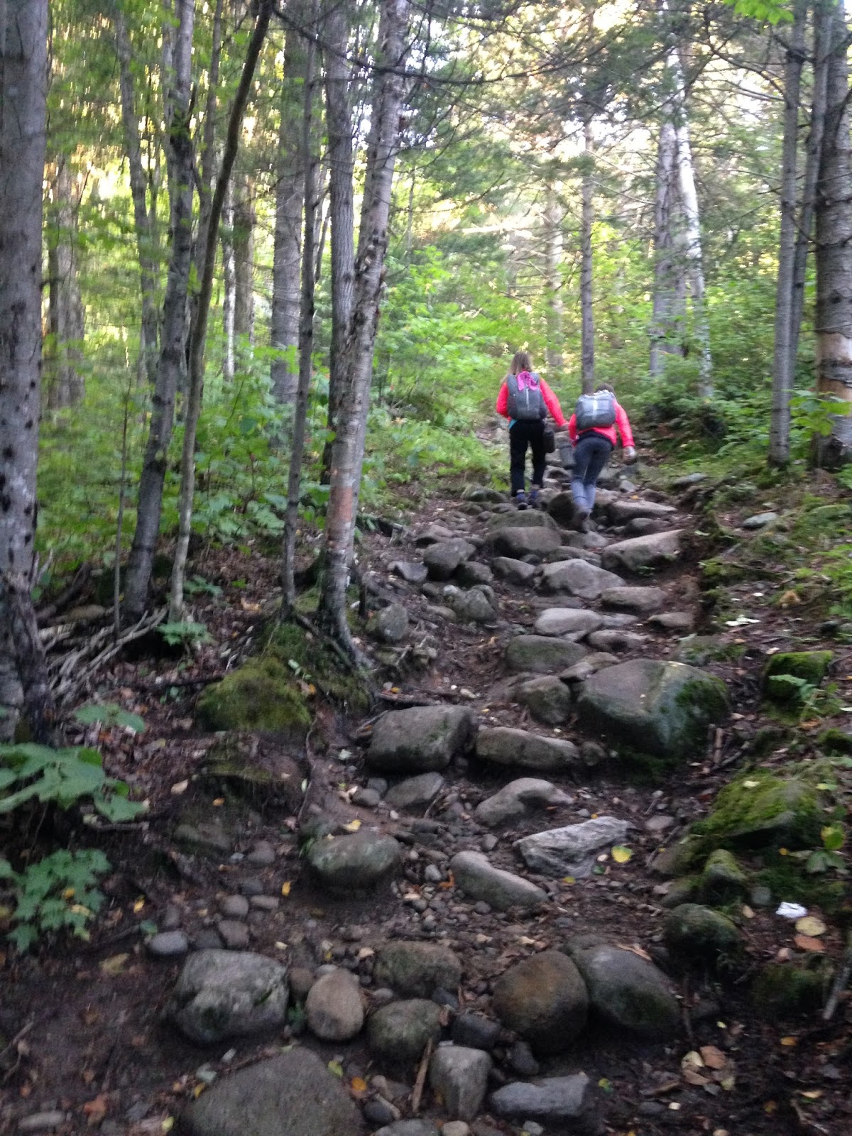
We have a system when we hike in mountain lion territory. I go last, since I am the tallest, and since I doubt a mountain lion is going to stalk me personally (I'm 5'10"). Alex goes in the front, since she's taller than Sage (though no longer by much), and Sage goes in the middle, since she's (barely) the shortest. We stick close together until we're above treeline. I know the chances of being attacked by a mountain lion are VERY VERY remote, but still...this arrangement makes me feel better since I'm hiking with my kids.
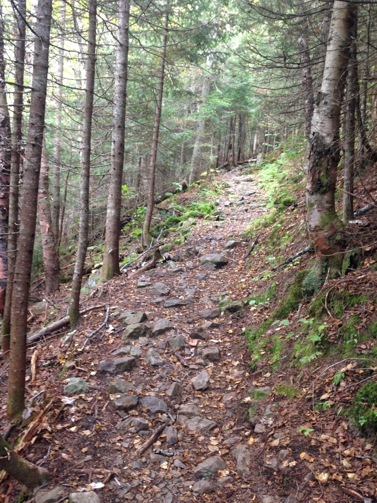
The first mile doesn't look all that steep, but it is steep and it feels steep. It's hard to describe. When we stopped to delayer, an older man (mid-60s..?) came zooming by on his way up. He was flying! We figured he was a local.
The sun came up and we removed our headlamps...
We took a short break after hiking the first mile.
Onward...
The second mile was much steeper than the first. Short switchbacks all the way up until we hit treeline at around 10,000 feet.
 |
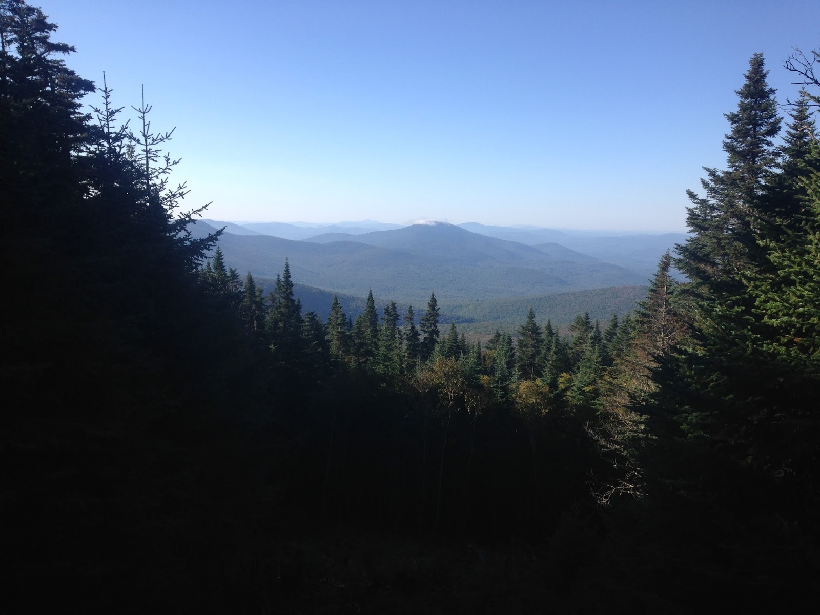
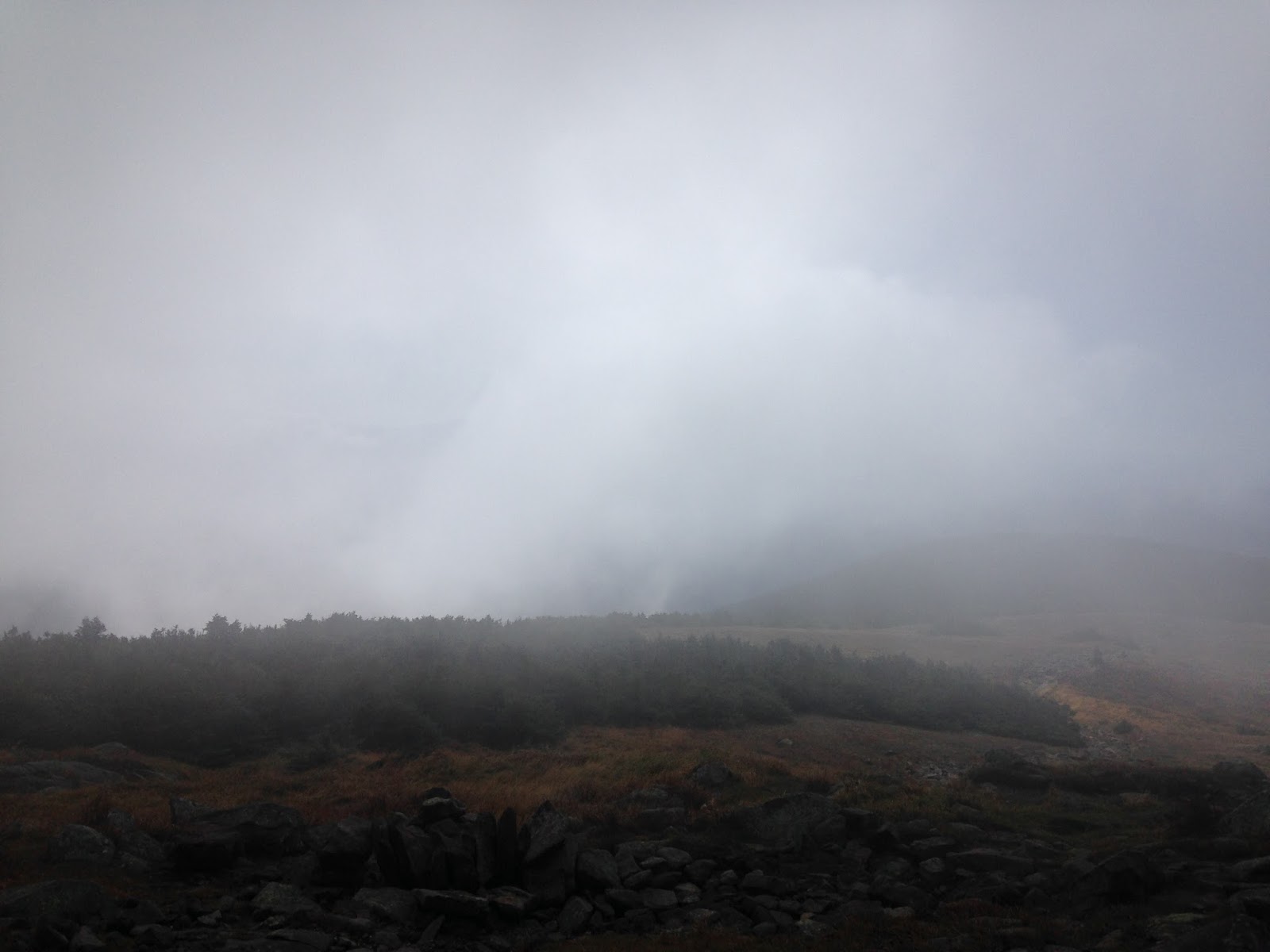
Treeline, looking down toward our car and the road.
The smoke is from the nearby forest fires. |
Once above treeline, we took another break and layered back up. My ankle felt fine, and no one had an altitude headache. On we went.
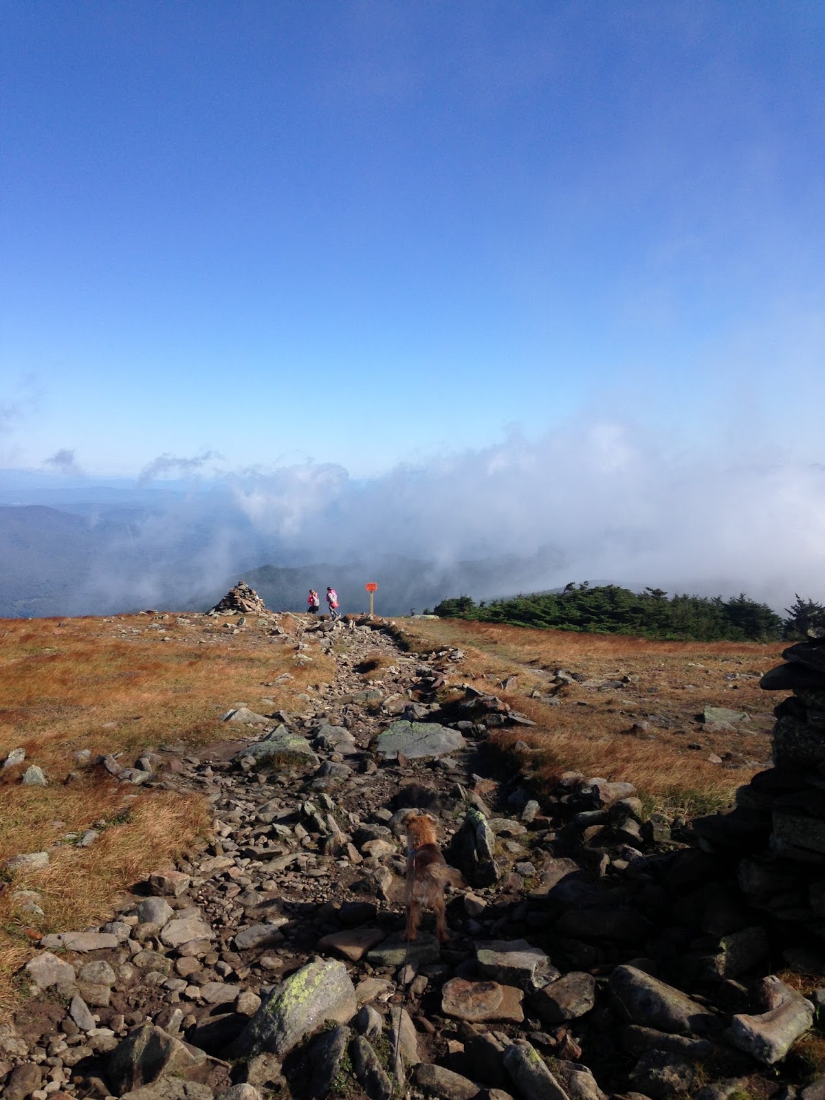
After you reach treeline, you walk along the ridge a bit...then this comes into view -- the path leads to Chicken-Out-Ridge...
 |
| COR on the right and the summit peak on the left |
We walked toward COR...along the way, we passed a group of four hikers with full climbing gear -- two men and two women from Buffalo, NY. We would leapfrog each other on COR, then we would get ahead of them for the day. They were nice people...more about their kindness later...
This is the beginning of Chicken-Out-Ridge. One must climb straight up this, then all the fun begins. This particular part wasn't difficult -- there are plenty of hand and foot holds. If you fall, however, you're going a long way down.
The view from partway up the climb.
The girls passed me...
Then I passed them (Alex took this photo)...
Immediately after that climb, there was a terrifying part. For me, this was the most difficult part of COR (not the downclimb that everyone talks about). You go up a chute-like notch (not scary, just be careful and watch your footing)...then you have to cross a gap (see the photo below...that's where you'll fall if you screw up this part of COR). To cross this gap, you must straddle your legs and step onto a crack...and the handholds are barely there.
 |
| Down you go if you get it wrong. |
Right when we reached that part, the older man who had passed us during the first mile passed us again, this time on his way down...he had already visited the peak. He skipped over the gap like it was nothing, then he told us that, in his opinion, that bit was the hardest part of the day (I agree!). He then flew down the rest of the mountain at the speed of light.
I stood there and panicked for a while, then I got up my nerve and did it. Once across, I could anchor myself in a position where I could reach out and grab the girls' hands, one by one, as they stepped over the gap. This way, if they slipped, I could yank them over. They didn't slip, and they each handled it like it was a walk in the park, but I still think that is the most dangerous part of the hike.
After that bit, you traverse along the side of the ridge for a while...if you look carefully when you're there, you'll see a subtle dirt path along the rock. After the gap, you go down a bit, then across, then up and around to the end of the first half of COR.
 |
| Me (and my arm) traversing...Alex took this photo. |
 |
Coming around to the end of the first half of COR. The second half, the "black band," is ahead...
for the black band, you want to stay right on top. |
Once you have finished the first bit, you want to climb up the second bit and stay right on top.
 |
| A photo I managed to get while climbing to the top of this section. |
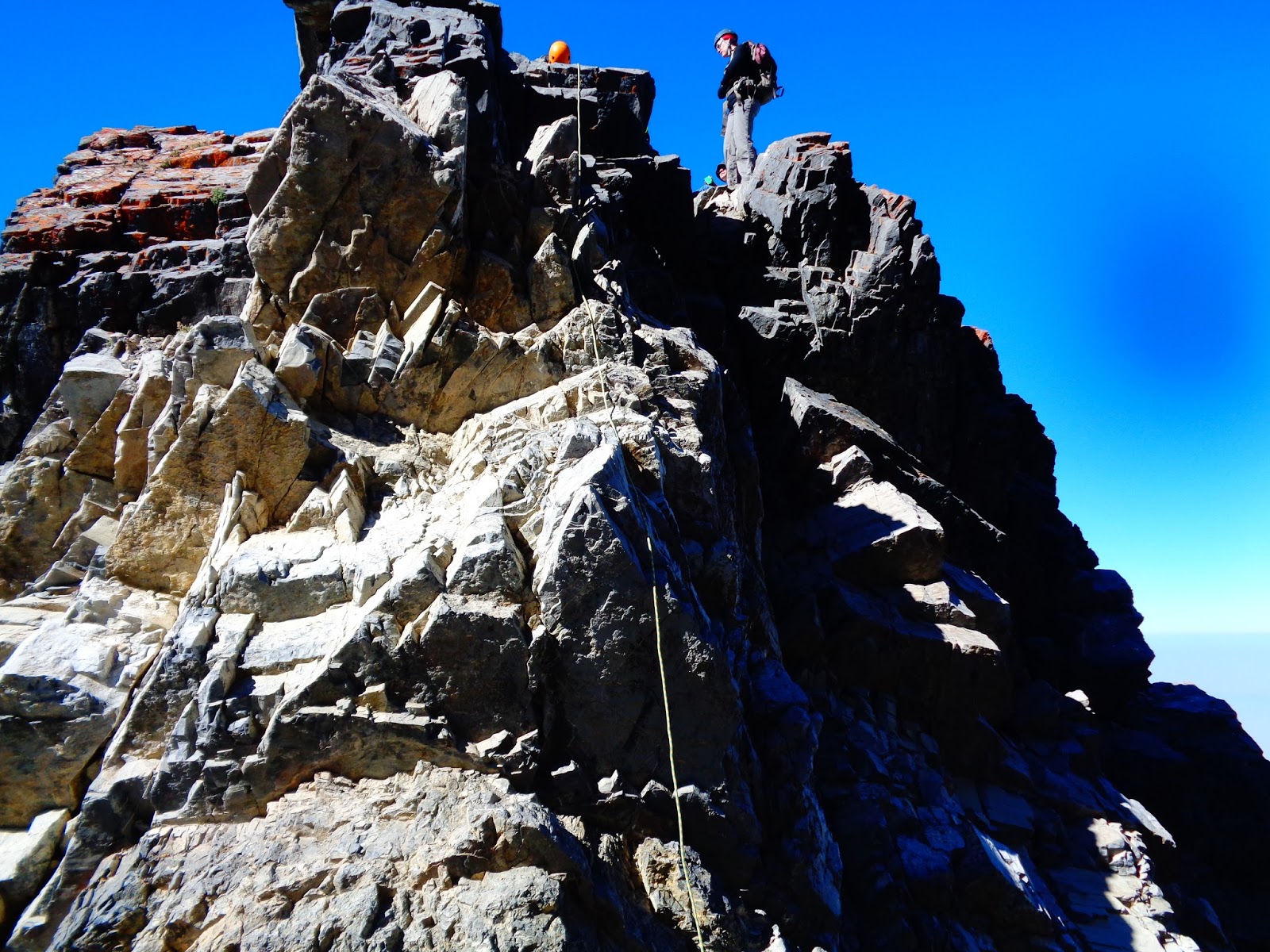
Most of the time, this section wasn't too difficult. The exposure is huge -- don't fall! -- but the hand and footholds are all there. There was one bit that took me a while...I had to swing a leg over a boulder right on top of a ridge. The Buffalo crew passed us again at this point (we had played leapfrog on the ridge until now), and finally I got up my nerve and got my leg over. Before I could turn to help the girls, both of them flew over it on their own.
After that, we were very close to the infamous downclimb.
 |
| Alex took this picture of one of the fellows from the Buffalo crew. |
Right before the downclimb, there's a spire of rock that you go around. When you're there, look to the left and down...you'll see a faint path-like thing...go down a bit, around, and then climb back up to do the downclimb. Sounds confusing, but if you look hard when you're there, you'll see the way.
 |
| The Buffalo crew just ahead of us, almost at the downclimb. |
We reached the top of the downclimb and a bottleneck ensued. It was us, the Buffalo crew, then three male climbers and a young couple who had caught up to us. The Buffalo crew fixed a rope and one of them went down...but he realized the rope wasn't really necessary since there were solid hand and footholds. I went second -- the Buffalo guys said the girls and I could use the rope if we wanted to, and that was very kind of them. However, I found I didn't need it either, and neither of the girls used it (but, again, it was very nice of them to allow us to use it if we wanted to).
 |
Alex takes a photo of Sage at the top of the downclimb while they wait for
me to finish descending. |
Alex took this shot of the downclimb after she descended.
We walked across the saddle -- which is usually full of snow, which makes the downclimb much more dangerous than it was on this day. I took a photo of everyone before the girls and I proceeded up the mountain.
On we go.
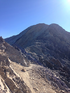
The path takes you around a false summit, the down onto another saddle.
 |
| Sage took this photo -- look at all that settled smoke! |
 |
| Sage took this photo of me looking at what we have left to ascend. |
 |
| Beautiful valley down there! |
Up up up -- and this part was difficult. Scree, scree, scree. You could choose a route that takes you up solid rock...but that way involves more scrambling, and we wanted a break from that. We slogged up loose scree for what seemed like forever, and all of us had altitude headaches from about 11,700 feet onward.
Views on the way up --
Finally..summit!
We signed the register and admired the views.
We ate a substantial amount of food, then the girls took a catnap (their headaches were thankfully gone).
The Buffalo crew arrived a little while later -- I offered them some of our Oreos and thanked them again for being generous with their rope. We left before they did, and we didn't see them again. Hope they made it back to NY safely.
After 45 minutes on the summit, we headed down. Descending that loose scree was time consuming and difficult! When we reached COR, the team of three guys who had caught up with us at the downclimb were now ahead of us, and instead of climbing back up the downclimb, they traversed this section of loose scree (see photo below) and took that faint path. That path bypasses the second part (second on the ascent, first on the descent) of COR.
The girls wanted to go back up the downclimb, so they scampered up. I got almost all the way up, then I had trouble with a foothold and just froze there for a while. The girls were getting worried and I began to feel like the biggest wuss in the world, so I hollered at myself to MOVE already and hauled myself the rest of the way up. Sage told me later that the scariest part of COR was worrying about me...during my three problem sections, both girls worried a lot about me. I spent all my time worrying about them (though they were total rock monkeys).
Once on top of the downclimb, we decided we'd climb down the rest of the ridge at an angle to meet that bypass trail...that was interesting...it was a screefest trying to get down there, and now I see why so many insist that it's much easier to just stay high on the ridge. I lost a Nalgene bottle at one point...an overhanging rock snagged the cover and it came out of my pack, rolled away from me, and went off an overhang. I couldn't retrieve it -- I am sorry for leaving Nalgene litter on the mountain. I picked up all the trash I saw (which wasn't much) on the way down to try to make up for it.
We eventually got back to the first part of COR, and, before I knew it, I found myself staring at the evil gap again. I was bolder this time and got myself over it faster than before. Once again, I anchored myself and grabbed the girls' hands as they came over. Then we were on the chute/notch, then we were on that initial climb, and then we were on solid ground.
We walked down a bit, back to the nice dirt trail, and congratulated ourselves.
NOW I could relax. The girls wanted to hoot and holler on the summit, and we did, but I knew this hike wasn't in the bag until we had come back across Chicken-Out-Ridge. Now we had. I was certain that if anyone fell or injured herself at this point, that we could hike/crawl ourselves out.
We hugged each other, then we began the rest of our descent.
Looking back at where we'd been...
Heading down...
We see the parking lot!
It was at this moment that my ankle began to hurt. Not a lot, just a dull ache.
Back at the car!
We arrived at 5:20pm. 11 hours and 40 minutes to do this hike, and that includes a 45 minute break at the top. Not bad for a woman with a sprained ankle and three people who didn't really acclimate.
Random notes --
The three guys who caught up with us, then were ahead of us on the descent -- one of them was an older fellow and he was very sweet and talkative. I noticed the three of them had stopped and were hanging out on the trail past COR on the descent...I got the impression they were waiting to make sure we made it through. All three were kind, and I didn't mind them checking on us. They were respectful about it, and they were a pleasure to talk with.
The couple who caught up with us...the woman was wearing jeans. The hiker snob in me wanted to feel indignant...but she flew by us on the ascent and then passed us going down as we were still going up, and, according to what she wrote in the register, this was her 42nd highpoint. So hey, some hikers can wear jeans.
I like to compare hikes out west to trails in New Hampshire. I can't with this one. COR is different. Imagine a much more exposed Huntington Ravine Trail with trickier sections, yet, for the most part, with decent hand and footholds. COR is more difficult than HRT, but if you are used to HRT and if you greatly enjoy HRT, then you can probably figure out COR.
It's been over two weeks since this hike, and my right ankle looks like it is now permanently larger than my left one. It is not 100%, but it is probably 92-95%. I can no longer point my foot all the way, but I can hike, walk, swim, hop, etc. I will continue to keep it wrapped when I hike. Hopefully it will be okay in the long run. I have two very active children and I can not sit around all day with my foot up...so I am going to hope that it is healed enough and that the new large size turns out to be an improvement.
The girls and I have not yet decided what next year's highpoint will be. We have a lot to discuss and some new skills to learn.
We'll be back on the New Hampshire trails soon. Hope everyone had a great Labor Day weekend!