19.8 miles with about 8500 feet of elevation gain.
Our first Presi Traverse!
I was fairly certain the girls could handle this, and I was excited to try this feat myself, so I had been looking forward to this traverse for weeks. We set a date with our friend John, who planned to hike with us, and we checked the weather forecast daily in the half-week that preceded our hiking day. The wind speed looked like it might give us some trouble on the northern summits, but the girls and I have hiked in high winds before, and we knew that hiking would be more manageable once we were off the actual summits and down on the ridge itself (while between summits). The night before our hike arrived...the forecast looked decent...still high winds, but dry and mostly sunny. The girls and I went to bed at 8pm and I set my alarm for 1:30am.
1:30 rolled around...I got up and got ready, then got the girls up and out the door. We had packed the night before and the girls were sleeping in their hiking clothes, so all they had to do at this point was transfer themselves to the car and go right back to sleep...which they did.
I met John near the parking lot for Jackson at 3am. We left his car there and drove to Appalachia, arriving at the trailhead for Valley Way just before 4am.
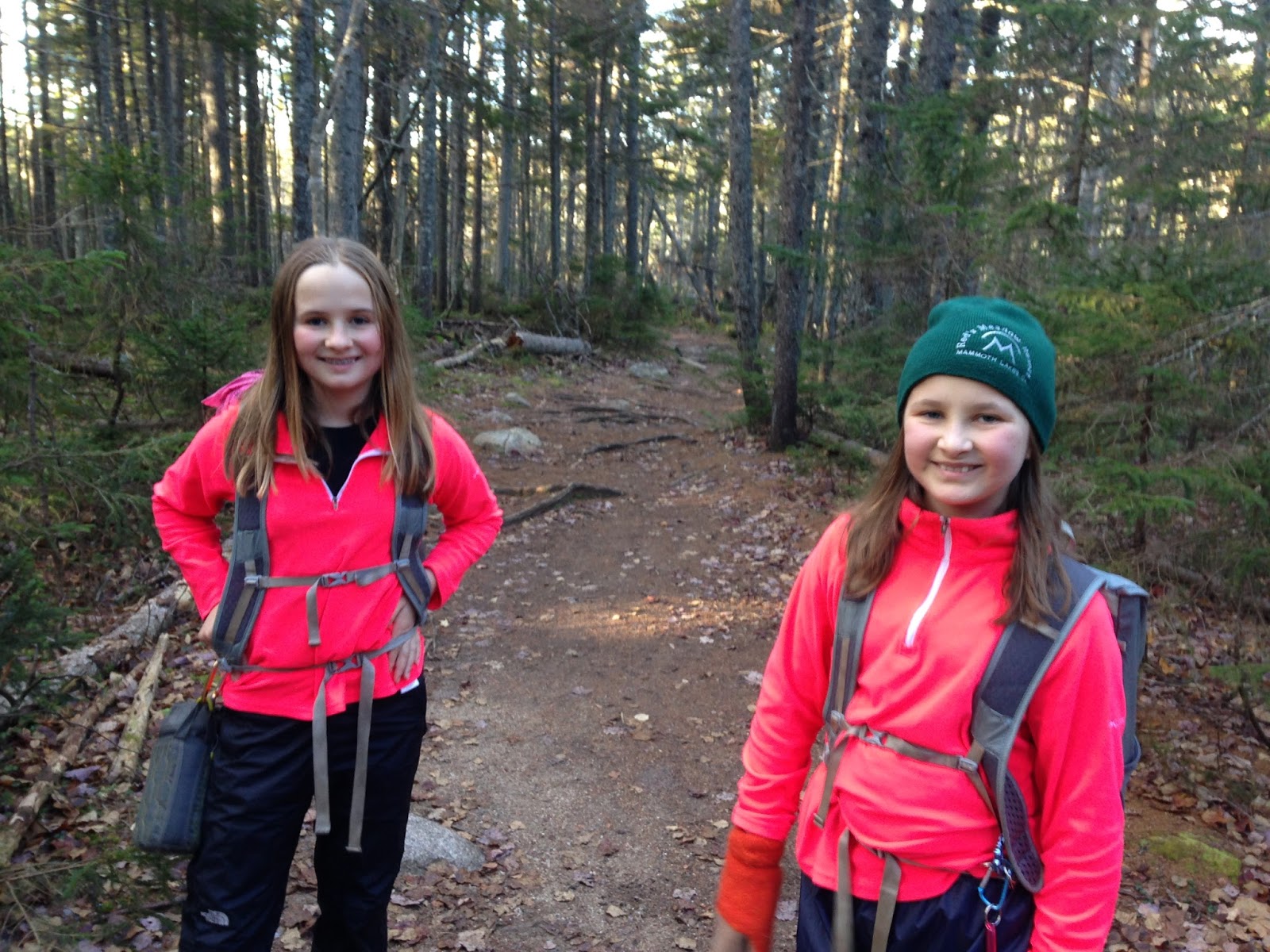
I woke the girls; we all geared up and hit the trail.
Later, both Alex and Sage said this was the most difficult part of the entire day. They were not really awake, and they were in headlamps, and all their bodies wanted to do was go back to sleep.
The girls hiked nearly all of the 3.8 miles to Madison Springs Hut (closed for the season) in silence...they were snooze-hiking.
Alex developed a stomach ache close to treeline. It was pretty bad, and I wondered if she was getting ill. She insisted she would be fine, so I decided to continue for now. If she wasn't fine by the time we were off Madison, then we could bail right back down Valley Way.
Near treeline, we saw the first signs of snow. The snow and ice would be here-and-there until Monroe, but never at an amount significant enough to make us regret our footwear choice of trail runners.
Almost at treeline...here's the "Turn Back or Die" sign.
The sun will soon rise...
Dawn broke just as we reached the hut. We dropped our packs and donned our hats (Alex got her balaclava too).
The wind was howling as we made our way up Madison's summit cone. From halfway up onward, we had to use our hands as well as our feet. Sage and I each got blown over more than once, and it was impossible to communicate with each other without screaming. The wind was cold, but the air temperature was too warm for frostbite. Sage's hat blew off her head at one point; she quickly caught it but did not put it back on for fear of losing it again.
We made our way to the summit and immediately hunkered down between some rocks.
Hands on summit, with Washington in the background.
Views from the summit. I could not stand to take photos, as the wind was blowing my hand and camera, so the photos from Madison are not as clear as I'd like them to be.
The way down (and toward Adams)...
View of Washington...
We fought the wind and headed back down to the hut. Once there, we ate a snack and the girls donned their rain/wind-proof pants. Sage also grabbed her balaclava. Alex's stomachache had vanished; she said it had gone away when the sun came up. I therefore felt comfortable heading toward Adams once we were sated and warm.
Here's Sage on the way up Adams, with Madison in the background -
View as we headed up Adams...
Adams! The wind situation was the same as it was on Madison. I have no idea how John managed to stand in the photo below -- I couldn't stay on two feet without being blown into the rocks and, as you can see in the picture, the girls needed to stay wedged in the rocks while we were on the summit.
Washington from Adams...
Eating, wedged between rocks on Adams...
Jefferson, our next peak.
The rock hop down Adams' summit cone was made especially interesting by the forceful winds...but we eventually got down and traversed to Jefferson on slightly easier terrain.
Just below Jefferson's summit cone (north side, coming from Adams).
Another snack before tackling another summit.
The approach up Jefferson's summit cone from the Adams side is much easier than the approach up the summit cone from the south or west -- there is less rock-hopping, in my opinion, which makes the feet happy. It was a steep climb, but short, and we were there in ten minutes. The wind, while present, wasn't nearly as forceful as it had been on Madison and Adams. We could kneel and stand without worrying about getting blown over.
 |
| On Jefferson |
View toward Washington from Jefferson...
View into the valley from Jefferson.
On we went, toward Washington.
The climb up Washington felt rough after having already done all the other northern Presidentials. That last few tenths of a mile felt awful on my knees, and my left leg began cramping. John and the girls were patient with me, and we eventually got to the summit. The wind speeds were strong on Washington (they usually are), but still not as bad as the wind speed on Adams and Madison.
There was a line of tourists (both the Auto Road and the Cog Railroad were open) at the summit sign. We docilely waited our turn, and one of the friendly Auto Road people took our picture.
After we clambered down the summit sign area, we went into the cafe/museum building and...holy cow! People people everywhere. Since it was Columbus Day Weekend, everyone in New England and beyond had apparently decided to ride up the Auto Road or Cog and spend the day inside this particular building. There was nowhere to sit until we lucked out and a couple of hikers moved off the bench the girls are sitting on in the photo below...we grabbed it and prepared to eat our Desserts on the 48 for Washington..Whitman's chocolates.
We devoured the entire box in about ten minutes.
Once fed and a teeny tiny bit rested, we headed back out the door, into the wind, and down the trail toward Monroe et al.
The footing south of Washington is so much better than that of the northern Presis! We were at (closed for the season) Lakes of the Clouds hut, and then up Monroe, in what felt like no time.
On Monroe, with Washington in the background...
Views from Monroe...
We headed down Monroe and toward Franklin/Ike/Pierce. The walk to Eisenhower from Monroe is one of my favorite stretches of trail in the Presidentials. The footing is kind, the path is relatively flat (compared with every other section of trail up there), and the views are stunning.
Eisenhower, which had looked so small and cute while we were coming down Washington, now loomed before us looking impossibly tall. Normally, this climb wouldn't be a big deal...but my legs were starting to get REALLY tired.
There it is again, we're closer now...I had to give a minor pep talk to my knees.
The climb up actually didn't feel all that bad. It was mainly psychological after having already hiked so many miles and experienced so much elevation gain. We got to the top and relaxed for a few minutes. The wind here was minimal.
The clouds were interesting and funky.
On Eisenhower, we decided our last summit for the day would be Pierce. Originally, we had planned on going over to Jackson after Pierce, but we realized on Ike that we felt close to being done. The standard Presi Traverse ends with Pierce, and trying to get Jackson after such a long and happy day might be pushing it. On Eisenhower, we felt like the day had been challenging, but awesome. We didn't want to venture into the this-is-too-much-and-now-I-hate-life zone.
Moving onward, to Pierce...
A little less than two miles later, we were on Pierce. The last summit of the Presi Traverse -- woo-hoo!
We sat down for about ten minutes and ate, then we headed down. We figured we'd get at least halfway down before needing to pull out the headlamps, and we were right. We made it perhaps half a mile past the intersection that leads to Mizpah before we were overcome by darkness and forced to dig out our light sources.
The last mile was the second-most-challenging part of the day (the first most challenging was the hike up Valley Way, when we all felt mostly asleep). The girls kept their spirits up by talking...for a while...and then they fell silent. We all did -- thoughts of hamburgers and milkshakes and getting out of my hiking shoes filled my head. Down down down we went...until we finally saw the road.
From here, it was a quick road walk to John's car...and we were done! Our total time was 15 hours and 15 minutes, which includes the time we spent on Washington wading through all the tourists. Not bad for our first Presidential Traverse!
The next day, both girls agreed that the Traverse was not nearly as difficult as they had imaged -- except for the very first part of the day and the very last part of the day. Basically, the dark parts of the day were hard, mainly because their bodies were telling them they should be in bed, asleep. Alex thinks her early-morning stomach cramps were due to sleep-deprivation and nothing else, since they disappeared as soon as the sun rose.
Our next few weeks will be filled with normal 4K dayhikes. Perhaps next month, we can squeeze in a Bonds Traverse (it would be our second, since we did one right after coming back from the JMT last year).
Happy hiking, everyone . Be safe out there!