If you haven't done so already, please donate to Feeding America! We are so close to reaching our goal!
We are now off to California! From now until September, we will post on our JMT blog and my Facebook page.
Please note that most of the updates between now and September will be posted on the Facebook page. A detailed, day-by-day account of our adventures on the John Muir Trail will be posted on our JMT blog when we return from California. Due to the relative lack of internet connection on the JMT, I will not be able to post an update each and every day as I was able to do last year on the Camino. I do promise a thorough account of our John Muir Trail travels, but it will have to be told in September, after we're back in New Hampshire.
Have a wonderful August!
Friday, August 1, 2014
JMT Training: Peaks 21, 22, and 23 of 21: South Twin, Southwest Twin (Trailwrights!), and Galehead
Hooray! We were able to get Southwest Twin!
Gale River Trail, Garfield Ridge Trail, Twinway, bushwhack. About 15 miles with around 4000 feet of elevation gain.
I don't have photos of our trip up Gale River Trail. This report focuses on Southwest Twin -- for photos of the standard trip to Galehead and/or South Twin via Gale River Trail, Garfield Trail, and Twinway, please click here, or do a quick google search for other folks' reports. Except for our "start photo" (below), our pictures begin near the summit of South Twin.
We woke at 3:50 am and were on the trail at 5:30am.

We quickly hiked up to Galehead Hut. We arrived at 7:40 and didn't linger. After filling our water bottles and using the bathroom, we tackled the steep climb to South Twin.
Near the summit of South Twin, we looked back down toward Galehead Hut, Mt. Galehead, Mt. Garfield, and Franconia Ridge.

We took a break on South Twin's summit and ate our Desserts on the 48 snack -- Strawberry Twizzlers.

We'd hiked fairly quickly with barely any breakfast in us, so we took some time to hydrate and fuel. The girls admired the views while eating almonds and, of course, Twizzlers.

The morning was clear and the views spectacular --


The girls and I managed to do exactly that on our 'whack to Southwest Twin's summit. We followed the Twinway south from South Twin and entered the woods after the second bog bridge (we're standing at the edge of that bog bridge in the photo below...bog bridges #3 and #4 are ahead of us).
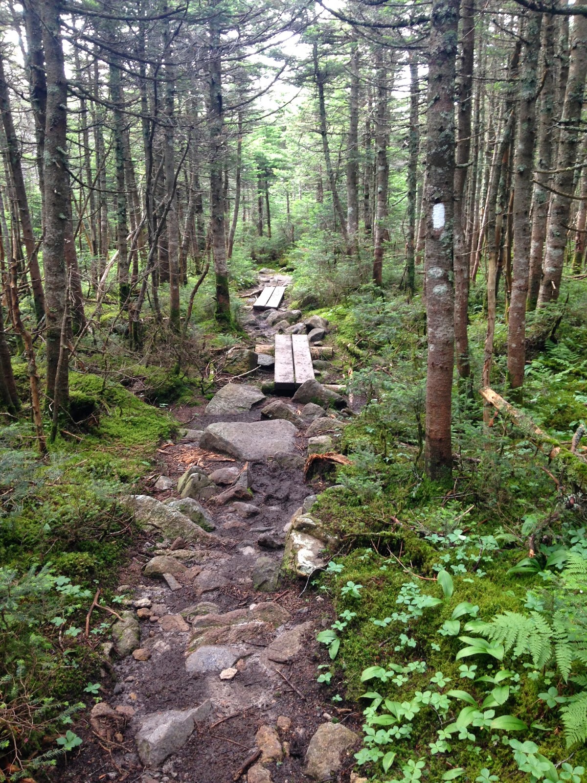
There's a herd path right after bog bridge #2 -- it leads to a stealth camp site.

We entered the woods here, then hugged the southeast portion of the ridge while 'whacking in a general southwest direction. Most of the time, our 'whack looked like this --

--or this.

The woods were pleasant to walk through and we found ourselves in the col, right in front of Southwest Twin, sooner than we expected. We had only one batch of fir trees to push our way through before entering the summit area.


After we made it through the thick bits, I turned and took a photo of Sage and the view toward South Twin.

On the other side of me, Alex was ready to enter the woods and reach the summit (which is a short distance from the spot where she's standing).

Alex hiked ahead of us...

...and I heard her excitedly shout, "There it is!" She had found the summit register (and the summit!).

Sage joined Alex...

...and took a few pictures of her own.


...and sat down for a bit. It was a lovely experience sitting there, eating Snickers, happy to have made it.
It had taken us only two hours to reach the summit from the Twinway. I wish I could say it took us only two hours to navigate back.
Unfortunately, on the return trip, I took us a bit too far north instead of northeast. We ended up in a nasty mess of thick trees and fir waves. A half hour after we left Southwest Twin's summit, I lost my map. We backtracked a bit, but we couldn't find it. Though I felt bad for accidentally littering the peak, I was not concerned -- we knew we would eventually pop out on the Twinway if we continued in a north or northeast direction. We therefore continued onward, crawling, pushing, pulling ourselves forward, swimming through, around, and under branches thickly intertwined...my forearms are shredded and Sage now sports a nice cut across her forehead. Eventually, we realized we were close to the summit of that left bump in the photo I previously posted (view from South Twin). We were so close to that bump's top...we figured we may as well climb/crawl our way up and tag it. We did...not much there, just more fallen-over trees and thickly intertwined branches...we now refer to this particular summit as Mt. Crappybump. We could, however, see South Twin's summit (and hear the people on it!) from the top of this jumbled mess. We crawled/climbed down the other side and headed in a north-north-east direction. Three and a half hours after leaving Southwest Twin's summit, we popped onto the Twinway at the bottom of the initial descent from South Twin.
From here, we practically ran up South Twin (it's amazing how easy normal trail feels when you first come off a bushwhack!). The girls wanted to sit for a while at the top, so we did...but we couldn't stay as long as they wanted because I was worried I'd never get back up again. All my muscles were sore and I risked turning into the Tin Man if I didn't keep moving. We therefore spent only ten minutes on South Twin before heading down to Galehead Hut.
Once at the hut, we refreshed ourselves with muffins and lemonade. We then left our packs and headed up the half mile to the summit of Galehead...where we ate Gummies (Lifesavers version).

The hike out was one of the most difficult I've ever experienced. The girls were fine -- they walked ahead of me at a brisk pace, talking the whole time. I had to repeatedly tell them to wait for me, because I could not move quickly at all. My entire body was fatigued. I stopped a lot and drank a ton of water, and the girls were patient with my slow progress. We made it back to the trail around 7:30pm.


Alex is happy and proud to have gotten this peak, as she should be. Sage is happy and proud too -- turns out that after Alex finishes this list, Sage will have only 16 Trailwrights peaks to go. She's accompanied Alex and me on so many of these peaks that she's not too far from finishing the list herself. She and I will ascend her remaining peaks on a relaxed basis during the next two or three years.
Alex's remaining Trailwrights peaks are: West Bond, Adams 5, and Sam Adams. We'll get those (and Sage's remaining 52WAV peaks) in September and/or October, after we return from the JMT.
Gale River Trail, Garfield Ridge Trail, Twinway, bushwhack. About 15 miles with around 4000 feet of elevation gain.
I don't have photos of our trip up Gale River Trail. This report focuses on Southwest Twin -- for photos of the standard trip to Galehead and/or South Twin via Gale River Trail, Garfield Trail, and Twinway, please click here, or do a quick google search for other folks' reports. Except for our "start photo" (below), our pictures begin near the summit of South Twin.
We woke at 3:50 am and were on the trail at 5:30am.
We quickly hiked up to Galehead Hut. We arrived at 7:40 and didn't linger. After filling our water bottles and using the bathroom, we tackled the steep climb to South Twin.
Near the summit of South Twin, we looked back down toward Galehead Hut, Mt. Galehead, Mt. Garfield, and Franconia Ridge.
We took a break on South Twin's summit and ate our Desserts on the 48 snack -- Strawberry Twizzlers.
We'd hiked fairly quickly with barely any breakfast in us, so we took some time to hydrate and fuel. The girls admired the views while eating almonds and, of course, Twizzlers.
The morning was clear and the views spectacular --
From the summit of South Twin, we could see our target peak...and the two bumps to avoid. In the photo below, there are three bumps in a row, just over the close-up vegetation. Southwest Twin is the summit on the right. The middle bump and the left bump are between a portion of the Twinway and Southwest Twin. Philip Werner's October 2013 trip report and Bernie C.'s October 2012 trail conditions report advise staying on the Twinway until you're beyond those two bumps (the Twinway curves). You then follow the southeast edge of the ridge toward Southwest Twin. This route skirts those bumps and leads you through mostly open woods.
There's a herd path right after bog bridge #2 -- it leads to a stealth camp site.
We entered the woods here, then hugged the southeast portion of the ridge while 'whacking in a general southwest direction. Most of the time, our 'whack looked like this --
--or this.
The woods were pleasant to walk through and we found ourselves in the col, right in front of Southwest Twin, sooner than we expected. We had only one batch of fir trees to push our way through before entering the summit area.
After we made it through the thick bits, I turned and took a photo of Sage and the view toward South Twin.
On the other side of me, Alex was ready to enter the woods and reach the summit (which is a short distance from the spot where she's standing).
...and I heard her excitedly shout, "There it is!" She had found the summit register (and the summit!).
Sage joined Alex...
...and took a few pictures of her own.
We signed the register (no one else had signed it since October 2013!)...
...and sat down for a bit. It was a lovely experience sitting there, eating Snickers, happy to have made it.
It had taken us only two hours to reach the summit from the Twinway. I wish I could say it took us only two hours to navigate back.
Unfortunately, on the return trip, I took us a bit too far north instead of northeast. We ended up in a nasty mess of thick trees and fir waves. A half hour after we left Southwest Twin's summit, I lost my map. We backtracked a bit, but we couldn't find it. Though I felt bad for accidentally littering the peak, I was not concerned -- we knew we would eventually pop out on the Twinway if we continued in a north or northeast direction. We therefore continued onward, crawling, pushing, pulling ourselves forward, swimming through, around, and under branches thickly intertwined...my forearms are shredded and Sage now sports a nice cut across her forehead. Eventually, we realized we were close to the summit of that left bump in the photo I previously posted (view from South Twin). We were so close to that bump's top...we figured we may as well climb/crawl our way up and tag it. We did...not much there, just more fallen-over trees and thickly intertwined branches...we now refer to this particular summit as Mt. Crappybump. We could, however, see South Twin's summit (and hear the people on it!) from the top of this jumbled mess. We crawled/climbed down the other side and headed in a north-north-east direction. Three and a half hours after leaving Southwest Twin's summit, we popped onto the Twinway at the bottom of the initial descent from South Twin.
From here, we practically ran up South Twin (it's amazing how easy normal trail feels when you first come off a bushwhack!). The girls wanted to sit for a while at the top, so we did...but we couldn't stay as long as they wanted because I was worried I'd never get back up again. All my muscles were sore and I risked turning into the Tin Man if I didn't keep moving. We therefore spent only ten minutes on South Twin before heading down to Galehead Hut.
Once at the hut, we refreshed ourselves with muffins and lemonade. We then left our packs and headed up the half mile to the summit of Galehead...where we ate Gummies (Lifesavers version).
The hike out was one of the most difficult I've ever experienced. The girls were fine -- they walked ahead of me at a brisk pace, talking the whole time. I had to repeatedly tell them to wait for me, because I could not move quickly at all. My entire body was fatigued. I stopped a lot and drank a ton of water, and the girls were patient with my slow progress. We made it back to the trail around 7:30pm.
Alex is happy and proud to have gotten this peak, as she should be. Sage is happy and proud too -- turns out that after Alex finishes this list, Sage will have only 16 Trailwrights peaks to go. She's accompanied Alex and me on so many of these peaks that she's not too far from finishing the list herself. She and I will ascend her remaining peaks on a relaxed basis during the next two or three years.
Alex's remaining Trailwrights peaks are: West Bond, Adams 5, and Sam Adams. We'll get those (and Sage's remaining 52WAV peaks) in September and/or October, after we return from the JMT.
Subscribe to:
Posts (Atom)