The Women's Leadership & Adventure Summit is this weekend! Hope to see some of you in Golden, Colorado!
After the Summit, the girls and I will mosey on over to Utah and attempt King's Peak. We'll keep you posted on our progress.
*****
Mt. Washington, up Nelson Crag Trail and down Lion's Head Trail.
Roundtrip mileage: about 9.5.
Elevation gain: 4500 feet.
The good folks at BlenderBottle recently sent me a GoStak. I took it on this hike and was pleased with its performance. Before we headed out, I loaded up the various compartments with different goodies. The stackable containers are easy to open and air/watertight when shut.
 |
| BlenderBottle GoStak filled with various goodies |
The girls and I arrived at Pinkham Notch at 7:15. The parking lot was almost full -- it was Sunday and the forecast was perfect, so this didn't surprise us. Later, when we returned from our hike, cars were parked up and down Route 2 for about a mile on either side of the lot.
We've been up Washington many times, each time using a different trail. For this ascent, we figured we'd introduce ourselves to Nelson Crag Trail, which has a reputation for being "stairmaster-ish." That reputation is well-deserved, as you'll see in the pictures later.
Starting out...one has to take Old Jackson Road from Pinkham Notch to get to Nelson Crag Trail...
Old Jackson Road alternates between flat and moderately steep...
The intersection with Nelson Crag Trail...
Nelson Crag Trail alternates between moderately steep and very steep all the way to the Washington's summit.
We popped out above treeline a few tenths of a mile beneath the Auto Road's 5-mile mark.
Continuing up...
Wildcat's ski area in the background...
Sage pretending to ward off an attacking cloud...
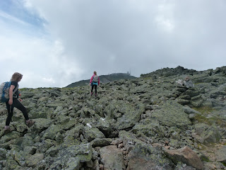
Looking ahead toward Nelson Crag...
Alex takes a snack from the GoStak...
Reaching the Auto Road's 5-mile mark.
Continuing up...
The top of Nelson Crag...
Snack break!
Onward, up Ball Crag (and past an Auto Road parking lot)...
Alex is wiggling her loose molar in the photo below...
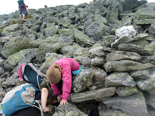
Halfway between the little parking area (6 mile mark) and the top of Ball Crag, Alex's tooth came out!
Unfortunately, she soon dropped it...
Sage spotted it just as we were about to give up.
We put the tooth in a safe place, where it couldn't get lost...
...and continued upward.
At the the top of Ball Crag...
Continuing the short distance to Washington's summit...
Across the railroad tracks...
Toward the summit cafe and museum...
Finishing the Nelson Crag Trail...
We got in the long line to have our photo taken at the summit sign (and I did the traditional grumbling of having to wait behind the folks who drove/rode up...I think there should be an express line for hikers, as elitist as that sounds...)...
Summit!
The cafe area was crowded!!! Felt like Times Square in there. I bought a few whoopie pies and drinks and headed back outside. The girls and I ate on a rock by the picnic tables (which were also swarming with people). The crowds were understandable -- this was Seek the Peak weekend, it was a nice day, and it was Sunday. Put those three factors together and you can expect roughly 8 billion people on the summit.
By the way, I want to give a shout-out to Heather, who kindly introduced herself while we were in line for the bathroom. She complimented me on my memoir, Up: A Mother and Daughter's Peakbagging Adventure. Thanks, Heather! It was nice to meet you. I'm glad you enjoyed the book.
It had been a few years since we'd checked out the Tip-Top House, so we spent a few minutes in the old hotel before heading back down toward the valley.
Since it was a gorgeous day and we had plenty of time (and headlamps, in case we ran out of daylight), I gave the girls four options for our descent -- 1) Lion's Head Trail, 2) Tuckerman Ravine Trail, 3) Boott Spur Trail, or 4) Glen Boulder Trail. Sage chose Lion's Head, so we hung a sharp left at the first intersection on the descent from Washington via Tuckerman.
Starting on Tuckerman...
Heading down...
Sage and I felt tired, but Alex zoomed along like she could have done a Presi Traverse. I told her to go ahead of us but wait every eight cairns or so. She'd fly ahead, then lay down and wait for us to catch up. Here she is, lounging at an intersection as Sage and I arrive.
Heading toward the "Lion's Head" outcropping...
Looking into Tuckerman Ravine...
Looking at Lion's Head from down the trail a bit. The girls and I can't see the Lion's Head in the formation, though Alex thinks she can see Dumbledore on the left.
A close-up of Dumbledore...
The rest of our descent was long...the last bit of Lion's Head Trail went by quickly and we were soon at the lower intersection with Tuckerman Ravine Trail...but that below-treeline portion of Tuckerman dragged on and on and on. Sage and I were ready to be at the car about a mile before the trail ended. Alex, on the other hand, bopped and skipped like she could have ascended another 4500 feet. She went ahead of us for a while until Sage asked for her company, then she patiently slowed her pace and finished her descent with me and Sage.
I feel good about our upcoming attempt of King's Peak (the highpoint of Utah). Kings Peak has 4100 feet of elevation gain over 16 miles (one-way). Mt Washington via Nelson Crag Trail has 4500 feet of elevation gain over 5 miles (one-way). Kings Peak has a mile of talus...Mt. Washington has about the same. All that's missing is the altitude, and we're going to spend almost a week acclimating before we attempt the climb. Also, we did Washington in one day and we're planning on doing Kings Peak in three...so, if the weather is good, then we shouldn't have too much trouble bagging Utah's highpoint. Here's hoping, anyway.
Thanks to BlenderBottle for the cool food container. I can see myself buying more stackables and using them in all kinds of ways; GoStak isn't just for hiking....as I type, part of it is with Sage at her summer camp, holding her midday snacks.
Signing off for now...the next post will be from Peaks Foundation's Women's Leadership & Adventure Summit in Golden, Colorado.


No comments:
Post a Comment