This was a perfect-weather day, and we originally planned on doing Franconia Ridge. The FR trails were, I had heard, sidewalks, the day was to be bluebird, and the sunshine bright. However, at the kitchen table, twenty minutes before leaving the house, we changed our minds.
Franconia Ridge is gorgeous, but we've done it several times. Sage and I share the mindset that we'd rather ascend a new-to-us peak than repeat the same thing over and over (except for the 4Ks we've haven't yet completed for our Desserts on the 48 quest). I looked online while the kids finished their cereal and discovered that the Lambert Ridge Trail was broken out. The Lambert Ridge Trail goes up Smarts Mountain, a 52 With a View we hadn't yet experienced. We threw our snowshoes in the car and I texted our new destination to our "safety folks" (people who know of our hiking plans).
Smarts Mountain is near Lyme, NH. It's the first significant NH mountain northbound Appalachian Trail thru-hikers ascend. There are several ways up this peak -- we chose the Lambert Ridge Trail, which coincides with the AT and, as I previously mentioned, had already been broken out by other hikers.

The trail goes up at a moderate grade for the first 0.8 mile. We were happy the path was firm. My snowshoes rode on my back for the entire ascent.

Reaching the first ledge (at 0.8 miles).

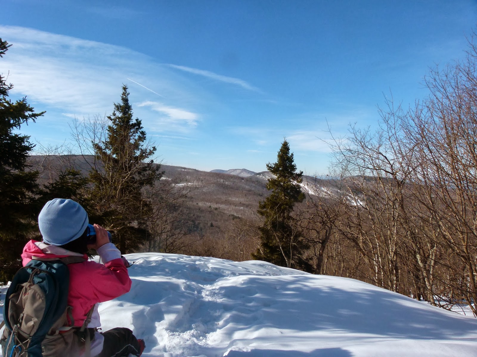
From here to the summit, the path visits multiple viewpoints. This is one of my favorite 52WAV peak so far -- so many opportunities for gorgeous scenery!


At 1.8 miles, one can see the summit (about 2 miles away).

Don't fall here!


The path was choppy (and firm) on the upper half of the trail. This didn't bother me...it never does. These are New Hampshire mountains, and hikers are free to choose how they ascend. Some folks love to use snowshoes, and others do not. Those who do not use snowshoes have every right to hike in the winter, though they do make things difficult for themselves once the snow reaches a certain depth.
There are a few (loud) hikers who become furious when they encounter a trail that doesn't look like it's been perfectly groomed...if there are postholes, or anything less than a smooth and obvious snowshoe track, they rail, complain, and insult other hikers online. I simply don't get that attitude. Sure, it's nice to have a smooth and firm path in front of you...but I don't expect anyone to hike the way I want them to just so I can have a trail that looks good and is easy for me personally. These are the mountains...I don't feel I'm entitled to an easy time of it out there. Yes, postholes can trip you up...but so can rocks, boulders, and roots, and no one expects the trail maintainers to smooth out the trails during the summer. Again...these are the mountains. Hike your own hike...and graciously allow others to do the same.

Reaching the intersection with Ranger Trail.

Beginning the last 0.6 miles to the top.


Fire tower (and summit)!

The girls began their trip up the stairs without asking my permission...my kids are old enough and experienced enough for me to trust their judgment, even though those steps were covered with ice.

The wind hit us full force once we were just underneath the enclosed top (which we couldn't get into). Alex and Sage seemed comfortable, but I was frightened. There's nothing much to prevent a four story fall onto rocks, the wind was forceful, the ice was everywhere...you get the idea. I wanted to take a slew of photos since the views up there are 360 degrees, but I was afraid to detach myself from the handrail. I was barely able to get my camera out of its case and snap a couple of shots from my waist (without looking through the viewfinder). Here are the two photos I managed to take.

I love the expression on Alex's face. She's as calm as I am panicked.

Sage was around a bend and up the final flight of stairs, so I couldn't get a picture of her on the tower.
We didn't spend much time up there as I was extremely worried one or all three of us would fall. We made our way down, then I snapped this shot of the tower itself.

We ate our snack at the nearby tent site, which had a little viewpoint and was sheltered from most of the wind. Here's Sage, happy about checking off another 52WAV.

This was a lovely hike with amazing views. The descent was a bit tricky because of the uneven trail and the softening snow...well, it wasn't tricky for the girls, since their relatively light weight kept them on (as opposed to in) the path. They therefore continued to microspike it. I, on the other hand, had to don the 'shoes, and life became difficult for a while since the now-smushy track was uneven from the barebooters. I kept my eyes open and watched my footing -- just as I do in the summer with rocks and roots -- and made it to the car without twisting an ankle or hurting my knees.
There's another snowstorm on the way for later this week, so I'm not sure if we'll hike on Friday. If we do, then I'll post our next trip report on Monday, March 17.
2 comments:
Once on Stratton Tower it was so windy I had to hook my elbow around one of the support beams in order to steady myself enough to take some pictures.
It was good to see you the other night, Dennis! Looking forward to hiking with you in July.
Post a Comment